
Walk a Redmond Street Record
A useful Redmond street-by-street search moves from place to record, not from an address to a claim about a person. First resolve the address to a county parcel. Then compare the tax record, recorded instruments, city project files, and dated local sources. Each step answers a different question. The King County Assessor connects the site address to assessment data, while the Recorder documents recorded land interests. A telephone book or newspaper can place a listed name at a dated locality. None proves who is inside a home now.
- Standardize the Redmond address and enter it in King County Parcel Viewer. Save the parcel PIN, situs address, legal description, and jurisdiction.
- Open the linked Assessor detail. Treat its name and mailing fields as tax-record data, not as a household list.
- Pan along the street in Parcel Viewer or iMap. Note adjacent PINs, address points, zoning, and city or unincorporated labels.
- Search King County Landmark by parcel where supported, then by grantor or grantee. Use Archives when the chain reaches older records.
- Check Redmond project records and dated library sources. Record the role, source date, and limits of every name found.
This sequence keeps the address, parcel, and person fields separate. It also creates a trail another researcher can repeat. For a whole named road, work in small segments and save the layer date before moving to the next group of parcels.
Normalize Redmond Street Names
Redmond adopted RFDS-020-32024 as its street-address standard effective March 15, 2024. It calls for uppercase text, standard direction and road abbreviations, no commas, and no punctuation except the ZIP+4 hyphen. Examples in the standard include AVONDALE RD, BEL RED RD, E LK SAMMAMISH PKWY, LEARY WAY, OLD REDMOND RD, REDMOND WOODINVILLE RD, and WILLOWS RD. A commercial, multifamily, or condominium site may use a base address plus a unit or building designator.
Keep the original form when researching an old item. A rural route, former road label, or directory spelling may be the only path back to a newspaper or deed. Search the current standardized form in GIS, then search the older form in historical sources. The two forms should be recorded side by side, not silently merged.
- Parcel
- A mapped unit of land tied to a county parcel identification number, or PIN.
- Situs address
- The physical address the Assessor associates with the property, distinct from a tax mailing address.
- Plat
- A recorded map that divides land into lots, blocks, roads, or other features.
- Criss-cross directory
- A dated directory arranged by address or phone number instead of only by surname.
Note: Preserve both the current Redmond format and the exact historic wording whenever an old directory, map, or deed uses another address form.
Map Redmond Streets to Parcels
King County's property lookup entry opens the route to eReal Property, while King County iMap adds the street and boundary context. The county PIN convention uses ten alphanumeric positions. The first six identify a major plat or subdivision component, and the last four identify the minor parcel. A minor value of 0000 can mark a condominium complex.
The successful assessor capture shows the official entry point used for Redmond address research.
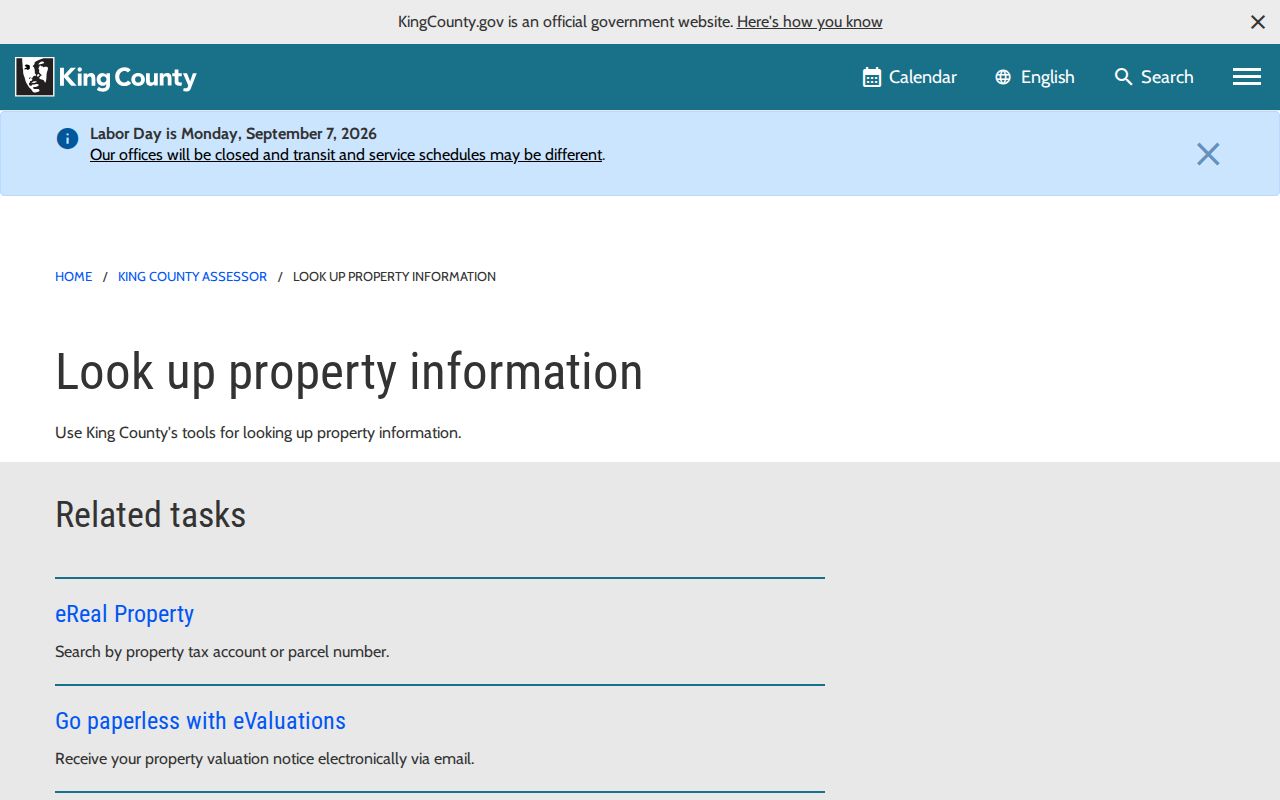
Use that screen to reach the live parcel detail, then save the source date because assessed facts and ownership fields can change.
| Redmond parcel control | Input type | Required? | Use and limit |
|---|---|---|---|
| Property address | Address text | Not confirmed | Enter the current situs address and confirm the returned parcel. |
| Parcel or tax account | Text | Not confirmed | Use a verified PIN or account path; check the live format. |
| Property detail | Action links | No | Links can include map, tax bill, glossary, area report, and printable detail. |
| Owner-name search | Text | Not verified | Do not promise this mode; use the address or parcel route. |
| Detail output | Record fields | Not applicable | May show name, levy, site address, legal description, land, and building facts. |
Browse Redmond Streets in iMap
iMap Basic Search accepts an address, parcel, place name, or street intersection written with an ampersand. Turn on parcels, parcel and address labels, ZIP codes, and the city or unincorporated layer. Other available groups can add recent sales, public lands, electoral precincts, flood data, and property interests. A clicked parcel is outlined in red and can link to Assessor and Districts and Development reports.
The captured King County iMap source documents the public map used for Redmond address research.
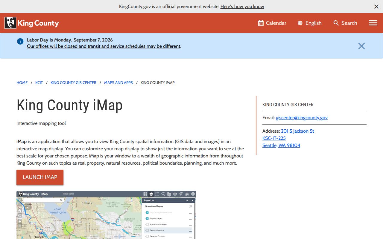
The image connects a street search to parcel and jurisdiction layers. It does not turn mapped parcels into a resident roster.
County address points derive from E-911 sources, join to Assessor PINs, and receive monthly USPS ZIP+4 updates. Several address points can sit on one parcel, and some parcels have more than one structure or none. Save the point, polygon, PIN, layer name, and map date. Parcel lines are for reference and are not a survey.
Redmond Records Indexed by Address
The same Redmond street can appear in several public systems, but each one has a narrow purpose. The parcel card describes assessment. GIS describes mapped context. A recorded deed documents an interest at a specific date. A permit lists project participants in stated roles. Elections data is controlled by state law, and the county self-lookup is not a public street roster.
| Address-linked source | Official keeper | Useful Redmond detail | Channel and limit |
|---|---|---|---|
| Assessor parcel card | King County Assessor | PIN, situs, name or mailing field, legal and building facts | Online current detail; not title or occupancy proof |
| Parcel and GIS layers | King County GIS | Parcels, address points, ZIP, zoning, districts | Public map; not a legal survey |
| Recorded instruments | King County Recorder and Archives | Deeds, liens, easements, plats, grantor and grantee | Landmark for most post-cutoff records; Archives for older material |
| Permit or land-use file | Redmond Development Services | Site, parcel, applicant, owner, contractor, project status | Recent Project Viewer window; request older files |
| Historical directory | KCLS, historical societies, archives | Dated subscriber, business, locality, or address listing | Online, library, microfilm, or appointment; incomplete by nature |
A PIN and legal description are the strongest joins between land records. Street text alone can change. When an online tool fails, use an office counter, phone or email support, library reference help, an Archives appointment, mail for copies, or a focused Public Records Act request for an existing city file.
Check Redmond Street Jurisdiction
A Redmond mailing label does not always mean the parcel is within incorporated Redmond. The city's own distinction places 98052 close to city-resident geography, while many 98053 addresses sit in unincorporated King County. ZIP 98073 is associated with PO Box or mailing use, and 98074 appears in adjacent administrative geography. None is a substitute for a parcel-level boundary check.
Compare four labels: the USPS delivery city and ZIP, the city jurisdiction, the county parcel jurisdiction, and the Assessor's site address. Around 98053 and the Sammamish plateau, those labels may differ. That difference decides whether Redmond or King County is the right custodian for permits, police files, and land-use records.
Note: A ZIP code routes mail; use Redmond and King County map layers to decide which public office holds a local street record.
Redmond Street Permit Records
Redmond Project Viewer filters projects by type, status, subtype, neighborhood, and start year. Types include city projects, property permits, and land-use actions. Status choices include completed, construction, design, and under review. The display has short windows: land-use actions remain for two years after completion, while above-grade structural permits and city projects appear for six months after completion.
An empty map result is not proof that no work occurred. Ask Development Services for an existing address or PIN-indexed file, giving the site address, parcel, permit type, and date range. The city also accepts public-record requests online and, under its procedure, by email, fax, mail, or verbally. The Washington Public Records Act generally calls for an agency response within five business days by producing records, acknowledging the request, or giving a reasonable estimate.
Permit forms can identify an owner, applicant, contractor, architect, engineer, or lender. Keep the stated role attached to the name. A permit applicant is not automatically the property owner or current occupant.
Follow Redmond Streets into Deeds
The King County Landmark index covers most recorded documents from August 1, 1991 forward. Parcel search is useful for a 1997-forward trail. Landmark does not index by street address, so resolve the Redmond site to a PIN and legal description first. Search results can include deeds, easements, mortgages, liens, leases, plats, surveys, condominiums, and nonconfidential name changes.
The captured Landmark screen marks the handoff from a street address to recorded-document fields.
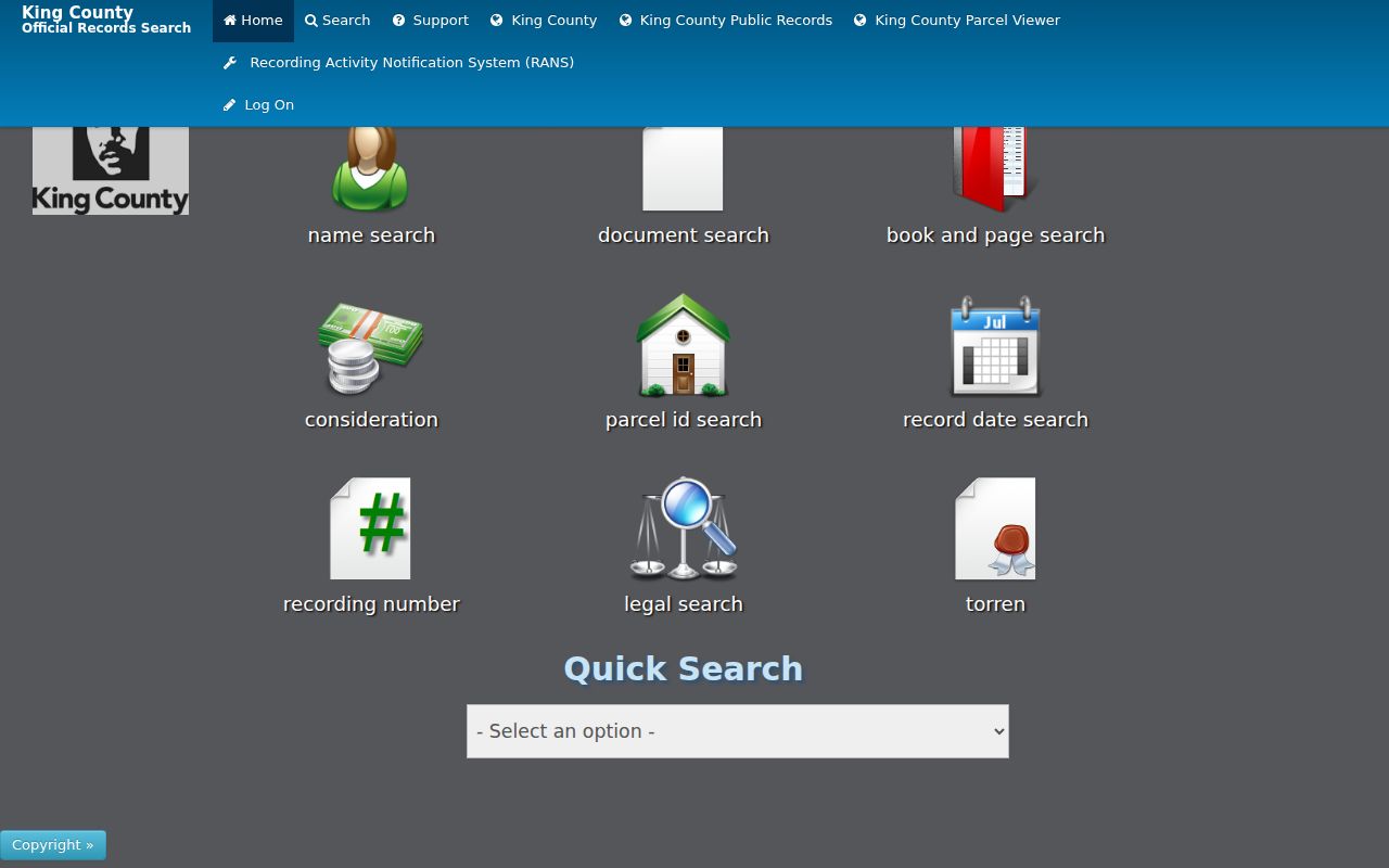
Use its indexed names, document type, date, recording number, parcel, and image status as dated facts, then verify the recorded image when needed.
For earlier instruments, contact King County Archives. It holds original recorded documents from 1853 through July 31, 1991 and provides a microfilm route for pre-cutoff work. Counter service, appointment research, phone or email help, and mail copy requests keep the deed trail open when the web index ends.
Historic Redmond Street Labels
Redmond's standard map collection includes a historic street-sign map dated September 10, 2024. It labels York Road, Conrad Olson Road, Perrigo Road, Railroad Avenue, Homestead Drive, Grass Lawn Road, Tosh Road, and Campton Road. Use a label as an index term in local newspapers, plats, deeds, telephone books, and the Redmond Historical Society catalog. The map itself is a reference, not a survey.
Boundary history matters too. Redmond incorporated in 1912. Education Hill was annexed in 1951, Overlake in 1962, Viewpoint in 1964, and Bear Creek in 1966. East Redmond existed as a separate city from 1956 until 1964. Much of the city's annexed acreage arrived from 1950 through 1970. Search a record under the jurisdiction and locality used on its date rather than forcing today's boundary backward.
Use Redmond Address Directories
Historical address sources help after the map and deed work. KCLS provides genealogy databases, Sanborn maps, census access, and newspaper microfilm. The Redmond Historical Society offers a searchable Past Perfect catalog, photographs, oral histories, obituaries, yearbooks, and the Sammamish Valley News archive. Digitized Kirkland-Redmond telephone books from 1944 and 1949 show subscribers, businesses, locality notes, rural routes, and dial numbers.
These sources are time stamps. A listed subscriber may not represent every household member, and a rural route may not map cleanly to a modern Redmond street. The historical collections themselves belong in the Redmond directory book; use them here only to test a specific address or older road name after the parcel chain is clear.
Note: Search initials, spelling variants, route names, and nearby dates before deciding that a Redmond address has no historical directory entry.
Limits of Redmond Street Records
A Redmond street directory cannot identify all current residents. Tax records name a party associated with assessment, and the mailing address may be elsewhere. Parcel Viewer shows geometry, not a household. A deed proves a recorded transaction or interest at a date. Project files name participants in a permit role. A directory shows a listed subscriber when it was published. Utility customers, guests, delivery recipients, renters, and other household members are not a public parcel field.
King County My Voter Information is a self-lookup that requires a combination of three fields. It does not return every voter on a Redmond street. State public-file rules also protect specified voters and Address Confidentiality Program participants, and ballot choices are not public. Never try to infer a protected location from a substitute address.
Lawful use. Use Redmond address records for careful personal, civic, property, or family-history research. Do not publish a private household dossier or use a result to stalk, harass, intimidate, or harm anyone.