
Sources Around Redmond Neighbors
Official tools describe parcels, owners, jurisdiction, planning areas, public projects, and limited voter information. They do not form a household roster. Begin with the source that fits the block question, and distinguish an owner from an occupant at every step.
| Source | What It Shows About a Block | Access |
|---|---|---|
| King County Parcel Viewer | Parcel lines, selected data, address and report links | Free viewer |
| Assessor eReal Property | Assessed owner, site data, account and mailing fields | Free lookup |
| King County iMap | Parcels with ZIP, city and unincorporated layers | Free map |
| Redmond neighborhood pages | Planning areas, descriptions and public projects | City pages |
| Historical sources | Time-stamped names and places on an older block | Libraries and archives |
A tax card can prove which owner the assessor associates with a parcel on the search date. It cannot prove who was inside a home that day. A voter record is also date-specific and subject to state use limits. Community sources may identify public contacts or projects, yet the research found no open member roster for Redmond neighborhood groups. Do not imply one exists.
Ten Redmond Neighborhood Areas
The City of Redmond neighborhood framework names Bear Creek, Downtown, Education Hill, Grass Lawn, Idylwood, North Redmond, Overlake, Sammamish Valley, Southeast Redmond, and Willows/Rose Hill. These are planning boundaries. They are not directories of Redmond neighbors or proof of an HOA.
| Public contact | Best use |
|---|---|
| City neighborhood pages | Planning context and area descriptions |
| City Clerk and Public Records Center | Existing city maps, plans, correspondence, or project files |
| Redmond Historical Society | Archived photographs, newspapers, oral histories, and place names |
No verified public member directory for local neighborhood groups, congregations, civic clubs, or block-watch groups appeared in the inspected sources. Use a group's published contact page if one exists, or request a city-held record by topic and date. Never guess a roster.
Planning names still help frame a block question. Downtown and Overlake are urban centers, while Sammamish Valley, Education Hill, Grass Lawn, Idylwood, Bear Creek, North Redmond, Southeast Redmond, and Willows/Rose Hill have different land-use settings. Choose the city neighborhood shown for a project or plan, then keep that planning label separate from a subdivision name, postal ZIP, homeowners group, or legal plat.
Redmond Neighbors Across 98053
A Redmond mailing address does not always mean the property lies inside Redmond. The city links 98052 with incorporated residents but warns that 98053 can cover unincorporated King County. Nearby parcels can therefore share a postal city while different agencies hold permits, police files, land-use records, and service maps.
Check the parcel against a city-limit layer in iMap or Parcel Viewer. Treat a ZIP as delivery geography only. This boundary step matters near the Sammamish plateau, where historical phone and ZIP labels also reached places outside today's city.
The custodian should follow the mapped jurisdiction. A city parcel may lead to Redmond Development Services, police records, or the City Clerk. An unincorporated parcel instead points toward King County planning, sheriff, assessor, and recorder systems. Preserve the USPS label and the mapped jurisdiction as separate facts. If the layers conflict, ask the city or county GIS office about the specific address rather than choosing from the ZIP alone.
Read Redmond Address Points Carefully
King County GIS documentation explains that one parcel can have more than one address point. Apartments, condos, secondary structures, corner lots, and new addresses can break a simple one-address-to-one-home assumption. The situs address is the physical property location; the assessor may show a separate mailing address.
Normalize local street forms such as REDMOND WAY, WILLOWS RD, AVONDALE RD, BEL RED RD, and OLD REDMOND RD before retrying a query. Preserve old rural-route wording for historic neighbors, then bridge it with maps and dated directories instead of forcing it into a modern address.
Address-point data can include USPS ZIP+4 and a parcel join, yet each field has its own source date and limits. Check the selected point against the parcel shape and site address. On a corner parcel, test both road names. For a condominium, search the condo name or unit-specific parcel when the viewer supports it. If the map shows several points on one parcel, do not treat those points as separate households without a record that defines them.
Map a Redmond Neighbor Block
King County Parcel Viewer accepts an address, parcel identification number, or condominium name. Start at one confirmed parcel and move only to the lots visible beside it. This creates a bounded block view instead of a citywide person search.
- Enter the full street address and verify the selected parcel shape and PIN.
- Click each parcel that directly borders the starting lot. Save only facts needed for the question.
- Open the linked assessor report to confirm the assessed owner and compare site and mailing fields.
- Add iMap city, ZIP, and planning layers when jurisdiction or boundary context matters.
Parcel lines in a viewer are not a survey, and owners are not a roster of your neighbors. For a whole named road rather than adjacent lots, use the Redmond street directory workflow.
The captured King County iMap source shows the gateway for combining parcel and administrative layers.
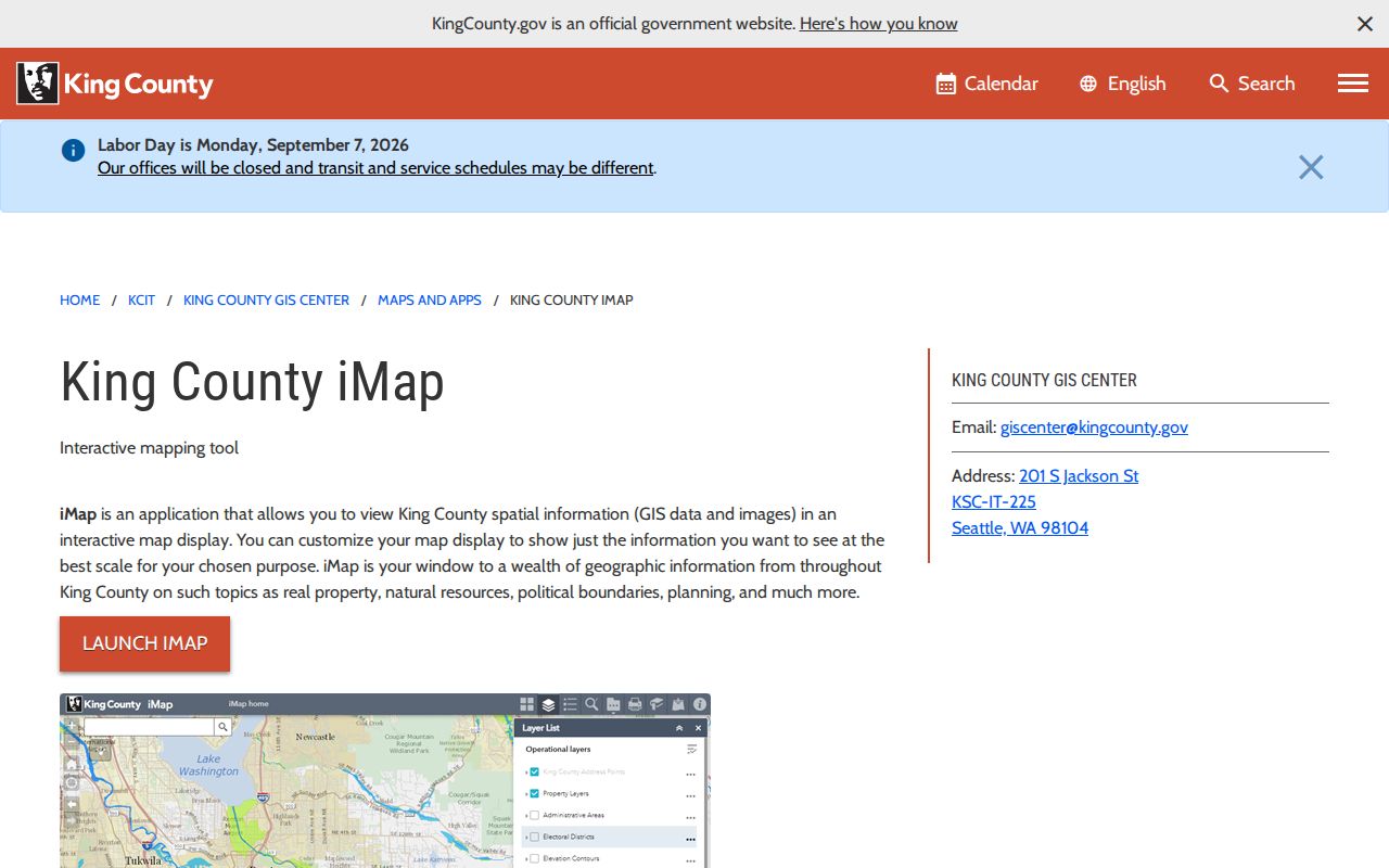
Use overlays to explain block geography, while the assessor remains the source for the current property account.
Redmond Projects Shared by Neighbors
Redmond Project Viewer adds recent land-use and permit context by project type, status, neighborhood, and start year. Its display is limited, so it is not a project archive. Development Services and REPS can hold fuller applications with site address, parcel, owner, applicant, contractor, and project details.
When a record is not online, the Public Records Center accepts requests online, by email, fax, mail, or verbally. Ask for existing permits, maps, notices, correspondence, or reports tied to an exact address, parcel, project, and date range. The Washington Public Records Act generally calls for an initial response within five business days.
A shared project can explain activity affecting several Redmond neighbors without identifying private household members. Public notice lists, hearing records, plats, traffic studies, and approved plans may define the affected site or public process. Ask for the existing record itself. The city is not required to create a new analysis or investigate a block in response to a records request.
Permit roles also need care. An application can name an owner, applicant, architect, engineer, contractor, lender, or project contact. None of those labels alone proves that the person lives on the block. Read the role and filing date beside the name. For older material outside the Project Viewer's display window, request the permit or land-use file through Development Services or the Public Records Center rather than assuming it vanished.
Meet Past Redmond Neighbors
The Redmond Historical Society's Online Archives includes photographs, obituaries, oral histories, yearbooks, and the Sammamish Valley News. KCLS connects researchers with telephone books, newspapers, census sources, Sanborn maps, and obituary help. The 1944 and 1949 Kirkland-Redmond telephone books are useful local snapshots.
A listed subscriber or news mention does not represent every member of a past household. Keep the date, page, exact spelling, and locality with the name. Boundary history matters: East Redmond incorporated separately in 1956 and disincorporated in 1964, while Sammamish incorporated in 1999 after plateau places had used Redmond phone numbers and ZIPs.
Historic road labels can unlock a block that modern tools miss. Redmond's map collection marks names such as York Road, Conrad Olson Road, Perrigo Road, Railroad Avenue, Homestead Drive, Grass Lawn Road, Tosh Road, and Campton Road. Compare one of those labels with a dated phone book, newspaper, plat, or parcel record. The match should rest on place and time, not a surname alone.
Official Redmond Block Evidence
Commercial neighbor tools may merge old addresses, names, and inferred ties. Official sources are narrower, but their custodian, date, and purpose are clear. Use the contrast to judge what a result supports.
| Source type | Strength | Key limit |
|---|---|---|
| County parcel and assessor | Official parcel and owner context | Does not prove occupancy |
| City planning and projects | Official boundary and public-project context | Not a household list |
| Library and archive | Dated local names and place evidence | Historical and incomplete |
| Commercial compilation | May surface a lead | Can be stale, merged, inferred, or wrong |
Return to the named custodian before repeating a fact. A small, sourced block record is more reliable than a broad profile assembled from unrelated names.
Protect Redmond Neighbors' Privacy
Public parcel data does not reveal every renter, child, household member, visitor, or current occupant. Utility, delivery, medical, and private account data are not public block directories. Washington's Address Confidentiality Program gives a substitute mailing address to eligible protected people. Do not try to uncover the actual address or defeat an agency redaction.
Save only what is needed for a lawful question. Avoid publishing personal phone numbers, full birth dates, minors' locations, or a compiled household dossier. When a record appears wrong, contact the source office and keep the dated response.
Lawful use. Research Redmond neighbors only for lawful personal, civic, or historical purposes. Never use a public name or address to watch, harass, intimidate, or harm anyone.